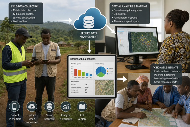
Many development, agricultural and community programmes generate large amounts of information in the field, but that information can be difficult to organize, visualize and use.
Digital Partners helps bridge that gap.
We combine GIS, digital data collection, participatory mapping and spatial analysis to help organizations transform field information into maps, datasets, dashboards and reports that are easier to understand and act upon.
Our solutions are designed for environments where users may have different levels of technical experience and where field activities may take place in rural or low-connectivity locations.
We work with communities and local stakeholders to identify and document important geographic features, resources, infrastructure, risks and community assets.
Participatory mapping allows communities to contribute their local knowledge directly to the mapping process.
We can map:
Outcome: Community-informed maps that combine local knowledge with geospatial technology.
We help organizations replace fragmented paper-based data collection with structured digital field data systems.
Using appropriate digital data collection platforms, field teams can collect:
Our systems can be designed for mobile devices and low-connectivity environments, allowing field teams to collect information efficiently and synchronize data when connectivity becomes available.
Whether you are planning a community mapping project, implementing an agricultural programme, conducting field research or building a digital monitoring system, Digital Partners can help you turn geographic information into actionable intelligence.
We guide businesses through end-to-end digital transformation, ensuring a smooth transition to the future of work and business operations.
8 AM - 6 PM , Monday - Saturday
Our Support and Sales team is available 24 / 7 to answer your queries